In this page:
- WIRADJURI NATION
- WHAT THEY MEAN (PLACENAMES)
- OLD GULGONG - Aboriginal Meanings
- 1899 - [GULGONG WAY]
- 1901 - [JIMMY GOVERNOR]
- 1916 - LAST KING OF HIS TRIBE
- 1917 - [ARTEFACT FOUND]
_________________________________
The idea of writing an Aboriginal history is a very white one. For Aboriginal people, life is a continuum of connections between ancestors, County and people; not then and now, simply "always". Knowledge was accumulated over thousands of years of close connection to the land and it was passed on in stories and songs.
Colonisation had a catastrophic effect on these age-old teaching traditions. Lives, languages and culture were lost through the introduction of diseases and the decades of Frontier Wars, as explorers and settlers competed for scarce resources with the custodians of the land. This article does not claim to know Aboriginal history. Rather, it is a telling of the arrival of white men in the Gulgong district and a record of the impact on the Wiradjuri people (where known).
I acknowledge that for centuries before invasion, the Wiradjrui people were the custodians of this land and they lived sustainably and harmoniously in the natural environs of the rivers, hills and forests that surround Gulgong today. They were blissfully unaware that a shiny rock under the land they cared for would bring hordes of men, greedy for riches, who would destroy the forests, tear up the ground and take Wiradjuri homelands for themselves.__________________________
The following information is what I have gathered from various sources to paint a picture of Aboriginal life in the Gulgong district. Many of the sources quoted were written at a time that did not value the rich culture and traditions of Aboriginal people and used language that reflected a very regrettable attitude. That language is quoted as used by the journalists and citizens of the day. We cannot rewrite history but hopefully we can learn from it.
Gulgong - nguluman in local language - means "large waterhole". The town is surrounded by many place names derived from Aboriginal words. Gulgong was built on land inhabited by the Wiradjuri people before exploration west of the Blue Mountains - and a gold rush in the 1870s - saw an influx of white settlers and the dispossession of the traditional custodians.

As a child I was told that our property name, "Goodiman" (and presumably the Shire of the same name), was Aboriginal for "happy playground". Goodiman Creek, originally called Puggoon Creek, also carries the name.
According to the Wiradjuri Dictionary app:
gadhaang means happy or gladmanhang means ground, dirt or soil.
So, gadhang manghang would mean happy ground and it is likely that the Wiradjuri people were living happily here with encampments along Goodiman Creek. I have not yet found much information about the Aboriginal people of this district. Did they flee from the oncoming settlers? Were they all killed? There is only one recorded instance of a massacre in the region but that's not to say that there weren't others.
Chamberlaine, William Cox’s overseer at Mudgee, and two stockmen and an Aboriginal guide, killed 16 Wiradjuri, probably all men, including a leader known by the settlers as Blucher. The region was under martial law at the time. (Connor 2002:61)
Sources: SG 16 September 1824 -https://trove.nla.gov.au/newspaper/page/494925; Connor 2002: 61
We are credibly informed, that, up to the 6th instant, no fresh disturbance was known at Bathurst to have occurred, on the part of the black natives; but it has since been reported, from that part of the Colony, that some of them have been killed whilst in the act of driving off a considerable number of cattle belonging to Mr Cox, near Mudgee. It is probable, that within the last week the Magistrates, assembled in that part of the Country, viz. Major Morriset, Mr. Lawson, Mr. Rankin, and Mr. Walker, have proceeded in the direction of Mudjee with a sufficient number of settlers, supported by an Officer's party of the 40th Regt, to repress future violences.
Many more massacres are detailed in the Mudgee District History website. (See links above)
WHAT THEY MEAN
Aboriginal Place Names GULGONG DISTRICTGULGONG means a big waterhole, according to a list of Aboriginal names and their meanings printed in a booklet edited by the late Mr W. W. Thorpe, ethnologist, and published by the Australian Museum.Other names and meanings are: —Biraganbil: Place of leeches.Birrawa: Many box treesGuntawang: A meeting place.Tallawang: Place of the apple gum.However, when the list was printed in the 'Mudgee Guardian' recently a writer from Turill stated that some of the meanings in the book were incorrect. In his corrections, he says: —Gulgong (abo. Goolgong) means crooked water, and the name belongs to a horseshoe bend in the creek about a mile or mile and a half south-west from the village of Home Rule and known in the early days as the shallow rush, and nearly opposite to where Mr T. Rowbotham now lives; that crooked turn in the creek is Gulgong proper. From where Mr Rowbotham lives to Mr Roth's at Gullamarra was known as Gulgong in the early days.Guntawang (abo. Goondiwang). Goondi means animal or human excrescence and wang or wong a rock or stone (excrescence on a rock).Tallawang. — Tal a log and wang a rock (log on a rock).
___________________________
OLD GULGONG - Aboriginal Meanings
A SERIES of articles of which this is one have been compiled from data collected by Mr. W. M. Claridge, recently on the staff of the Gulgong Public School. As far as could be ascertained from the sources available, the facts given are correct, the sole aim being to present a true record of Gulgong's past days. Mr. Claridge would appreciate information which may be available in regard to any unwitting misstatements.
By W. M. CLARIDGE
ARTICLE 2
It is not revealed whether settlement resulted directly from these early explorations, but the decision of Lawson and the Cox's to settle, along the Cudgegong opened up the Mudgee district, and soon holdings began to be taken up along the Cudgegong below Mudgee.
Though records of the Lands Department show these grants and purchases as being made during the 1830's, many of them were fulfilments of promises made as early as 1823 and 1825. Such were holdings like that of Henry Steel, who was given a grant of 2000 acres somewhere about the present Munna Railway Station. This grant is dated 9/4/1835, but was promised as early as 1823, while the property known as 'Wilbetree' was sold to the Lowe family in 1835, on a warrant from Governor Brisbane dated 3/5/1825.
Just how far along the Cudgegong was used in these days is not certain, as many 'permissive occupancies' were made by Governor Macquarie about the time that Lawson and the Cox's took up their land beside the Cudgegong, and these grants of Macquarie were not, recorded and some at least of the permissions were withdrawn.
However, we do know that the first lands legally occupied in the Gulgong district were granted, apparently for his services, to Richard Rouse, who came to Australia in 1801 as overseer of works in New South Wales on behalf of the Imperial Government. On his retirement from that position, Rouse took up the land on the Cudgegong known as Guntawang and Biraganbil, but before this some of the land he occupied was visited by Cunningham, who, on another trip, followed the Cudgegong back from the Wellington Valley. He writes in his journal (now in the Mitchell Library) that on December 1, 1825, "we came in again upon the bank of the Cugeegang opposite to a fine open or very thinly timbered tract named Gunterwong by the aboriginals." The Aborigianl meaning of 'Gunterwang' now spelled 'Guntawang,' is 'meeting place,' from which it appears that the site approximates the junction of the Cudgegong River and Wyaldra Creek. Cunningham's position as he writes of Guntawang opposite would place him on the Biraganbil estate, which occupied the south bank of the river as Guntawang did the north. The first promise of land to Rouse was made as early as 1825 by Governor Brisbane, but this area of 1200 acres was not actually taken up till 1833, for Rouse first received the 4000-acre block which formed the original Guntawang property. This was granted in 1828 and is the first recorded holding settled in the Gulgong district. During the next twelve years Rouse took up additional areas, and the position of these indicates that this first settler sought the best portions of land, especially those monopolising good river frontages.
Government Gazettes show the following [portions]??? having been occupied by Rouse in those years:
- 16/5/1828, 4000 acres, Guntawang, grant.
- 6/7/1833, 1200 acres, below and adjoining Guntawang, grant.
- 29/3/1836, 722 acres above Guntawang, puchase, £180/10/.
- 20/5/1837, 784 acres between and uniting the 4000 and 722-acre: blocks, purchase, £196.
- 19/7/1838, 1081 acres left bank Cooyal (Reedy) Creek near junction with Slapdash Creek, purchase, £270/5/.
- 29/6/1839, 851 acres Cooyal Creek near Cumbandry, purchase, £212/15/.
- 18/2/1840, 1118 acres adjoining the 851 acres higher up Cooyal Creek, purchase, £978/5/.
Before all these portions had been taken up, however, we find the first reference to the name Gulgong. Commenced by Oxley, a systematic survey was finished by Sir Thomas Mitchell of the original nineteen counties ,the official limit of settlement in those days. From this trigonometrical survey, Mitchell made the first map of the colony in 1831, and a reprint of this, dated 1834, is still preserved in the Mitchell Library in Sydney.
On this map the name Gulgong is shown on Cooyal Creek. Whether Mitchell merely placed the name there because of its native association (in the Aboriginal dialect it means 'deep waterhole'), or be cause; the name had already been transferred to the surrounding country, is not apparent, but it appears again at the same spot in 1839, when, on April 27, A. J. Liddington purchased 440 acres at 5/ an acre on the left bank of Cooyal Creek, opposite the present site of Home Rule. This purchase grant is described as being situated at Gulgong in the County of Phillip, parish unnamed.
______________________
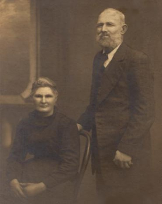
THE LIFE OF JIMMY GOVERNOR
Jimmy married Ethel Mary Jane (Page) Governor — in December 1898 in Gulgong. Their children were Sidney Golding Louis (Governor) Duncan and Thelma Reta Governor.
Jimmy died on 18 January 1901 in Darlinghurst, NSW.


______________________
1899 - [GULGONG WAY]
With no other information providing context, the following paragraph appeared in the Mudgee Guardian:
It is suggested that the aboriginals went Gulgong way to draw attention off Wollar. And then, as they think, possibly the tribe will be set at liberty.
Source: Mudgee Guardian and North-Western Representative (NSW : 1890 - 1954) Thu 2 Aug 1900 Page 12
The timing of the above article, however, makes it likely the "aboriginals" in question were Jimmy and Joe Governor. As the following article clarifies:
Also in 1900 the Kooris (Aborigines) at Wollar near Gulgong were forcibly moved to the mission station at Brewarrina because the Gulgong townsfolk had complained that the family of the notorious Koori bushrangers Jimmy and Joe Governor were living at Wollar and should be removed, together with all other Kooris, for the townsfolk’s safety.
Source: Maitland Mercury, 11 Sept 1900. Quoted in Koori: A Will to Win by James Miller.
1901 - [JIMMY GOVERNOR]
Twelve months ago this morning over 2000 rounds of Martini-Henry ammunition arrived in Mudgee to assist in blowing the life out of James and Joseph Governor. Both men were, however, pinked with bullets fired from bushmen's rifles.

Source: Daryl Pickett
He also used to go fishing with my great grandfather and my grandfather."
Source: Colleen Proctor
Mr. Cecil Winter, of Coolah, recently discovered an old headstone, bearing carved letters, believed to have been erected over the last black king of the Botheroo tribe. Further light has been thrown on this by Mr. C. Nevell, late manager of Weetalabah station, Coolah, who is at present residing in Queensland. Mr. Nevell explains, in a letter, as follows:—
Regarding the old relic of Botheroo, in the shape of a tombstone to Togo, the king of the Botheroo tribe, I had the stone cut in memory of a faithful old blackfellow, who was the last king of the Botheroo tribe. Evidently the weather has worn the lettering on the stone, as it should be Togee.When my grandfather (the late Mr. James Vincent) first took up Botheroo which then included Queensborough, Mooren, Dennykymine, Digilah, Moggymill, and Mumbedah, Togee and his tribe were quite wild. He was one of the blacks concerned in the massacre of four of Mr. Lawson's shepherds, about two miles north of where Denison Town now stands. It was also near Denison Town, on what the blacks called the Nullan Ridge, that Togee first saw a white man smoking, and to use his own words, "Me thought him dibbil-dibbil and me run like an emu,'' but kindness on the part of my grandfather tamed Togee and his tribe, who showed their gratitude when news reached them of his death by going into mourning, plastering their body and hair with pipeclay. They then disappeared from Botheroo, and when they returned they were still in mourning. They subsequently lived on at Botheroo, looking upon my father and uncle as masters.Togee was a commanding looking black; well over six feet, and a good shot with a spear and boomerang. He was an old man, and was standing not far from the house when he was shot by another blackfellow, ''Cut-a-Bush," who was jealous of his authority. Several whites carried the dying man, whose thigh was fractured, into a shed where he breathed his last. My father had a grave dug, and Togee, the last King of the Botheroo tribe, was buried. The tribe left as soon as he died, and never returned. Years later I had the stone mentioned cut and erected. [NB: The carving was done by George Weatherly].
Source: Leader (Orange, NSW : 1899 - 1945) Fri 24 Nov 1916 Page 2
1917 - [ARTEFACT FOUND]SYMBOL OF CHIEFDOM - ABORIGINE ARISTOCRAT.
Our illustration is that of a crescent-shaped brass plate, officially recording the social status of "Mickey, chief of Trinkee Plains." This symbol of chiefdom is one of those issued by the Government of N.S. Wales, and at one time must have been proudly worn by the owner around his neck on state occasions.
What happened to Chief Mickey, whether he be alive or dead or how he came to part with his insignia of leadership, is not known.

(N.S.W.) railway line. He struck it with his pick. Its present possessor is Mr. B. J. Naughton, a Gulgong hotelkeeper, who displays it in the bar of his hospitable inn.
[The plate may be seen by members of the Historical Society, in whose interests it will be held for week. -Ed. Globe.]
Source: